Politics & Society
Seeing the invisible vulnerable in our cities

An informal settlement in Iran provides an insight into the politics of place in our cities for the most marginalised people
Published 29 August 2022
Places are spaces that people have assigned meanings to and are attached to. Place-making refers to the interaction of people and place.
Places can also be highly political, as different groups have different power in placemaking. But who gets to define places in our cities? How does it affect people’s lives, especially the most marginalised groups?
In a multi-cultural country like Australia, considering the needs of different groups including people with diverse ethnic and socio-economic backgrounds and gender identities is key in ensuring inclusive and thriving cities.
Nonetheless, in most of the urban planning and urban design processes, there’s rarely any consideration for the marginalised groups in the society.
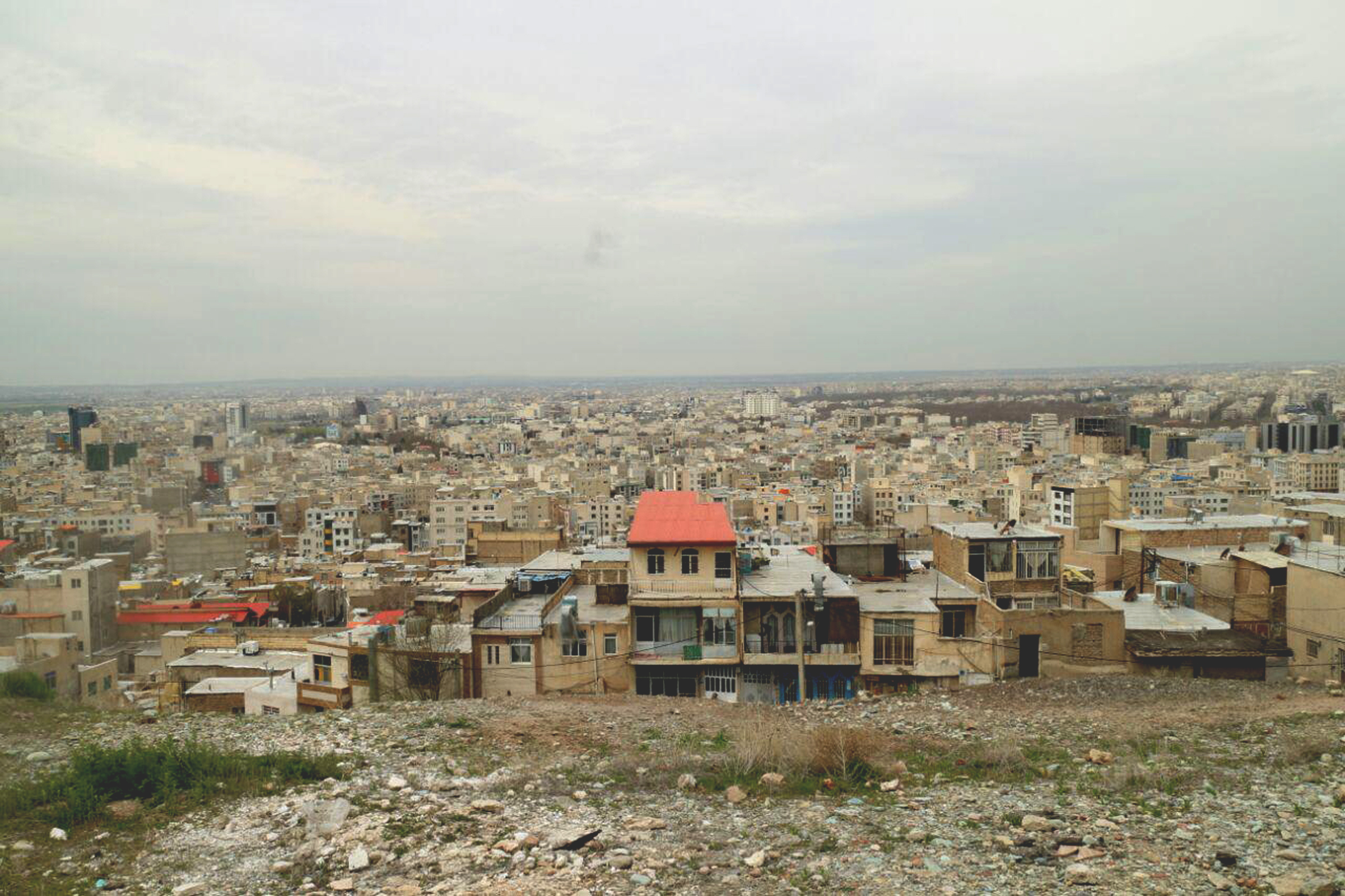
Shedding light on two different narratives of public spaces in an informal settlement in Iran called Eslamabad – which is in the city of Karaj just outside Tehran – indicates how the notion of public space and place is contested.

Politics & Society
Seeing the invisible vulnerable in our cities
I’ve explored the political dimension of place through planning documents, a documentary, online sources, social media, and interviews with residents. The key to understanding different views of a place is to ask whose view it is and who benefits or is marginalised.
Informal settlements – known as zoorabad or hashie-neshini in Iran – or slums, squats and favelas in other countries, refer to a range of contested informal tenures that lack formal planning, design and construction.
These settlements are strategic to the people living there – to improve their livelihoods by building houses close to their place of work because they cannot find affordable housing through the formal planning processes.
So, these settlements do not comply with planning regulations. Residents move on to land and build their houses without having a legal tenure. Then, they try to construct or put in infrastructure to obtain legal tenure.
As a result, most lack basic services, supporting infrastructure and security.
Eslamabad was built more than 50 years ago and has been contested ever since after residents built their houses illegally on land specified for agriculture land use, despite the fact they bought the land.
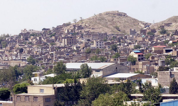
It’s situated on the hillside areas in the northwest of Karaj city. While it was once the home to some 120,000 residents at the peak of its occupation, there has been destruction and mass evictions.

Environment
Building resilience in remote communities
According to recent surveys, it now accommodates around 36, 000 residents around the hills.
The settlement has an organic and compact urban form with low-rise buildings for single or extended families that are built in line with the topography. As a result, the network of streets has formed organically – in parts highly sloped and more suited to pedestrian access.
There are two contrasting views of Eslamabad, each a result of a different process of place-making or unmaking.
On the one hand is the top-down view by the planning authorities, the other is the bottom-up opinion of the residents.
The unique situation of the settlement has made it the target of regeneration and rebranding to create a new landmark by planning authorities. A new vision for the area is one where the inner hill areas have become an open space with entertainment facilities designed to attract tourists.
But for the residents, they imagine a future settlement similar to the earlier full occupation of the hill with stepped housing but improvements in the buildings’ construction.
As a result, the focus of the urban planning authorities is on exaggerating problems and blaming the physical aspects of the place to justify mass evictions and the top-down restructuring and redevelopment.
For instance, planning documents emphasise massive restructuring of the highly sloped network of streets and the buildings, by highlighting open gutters on the streets, the difficulties of car access and unstable buildings.

Politics & Society
A long way from home
Planning policies mandate widening the street through massive setbacks on already small plots as a prerequisite for any reconstruction – this has resulted in further decay and residents’ apathy for reconstruction.
Policies like this have resulted in few new constructions, evictions of old residents and the emergence of vacant buildings and plots.
These scars are not only physical – their consequences are alienating the residents and leading to the loss of their social ties.
While in Eslamabad, I interviewed several of the women residents. They shared how everyday place-making allows social life to flourish on the streets because they are pedestrian and semi-private.
These same streets provide a safe space for kids, especially girls who face extra restrictions, to socialise and play.
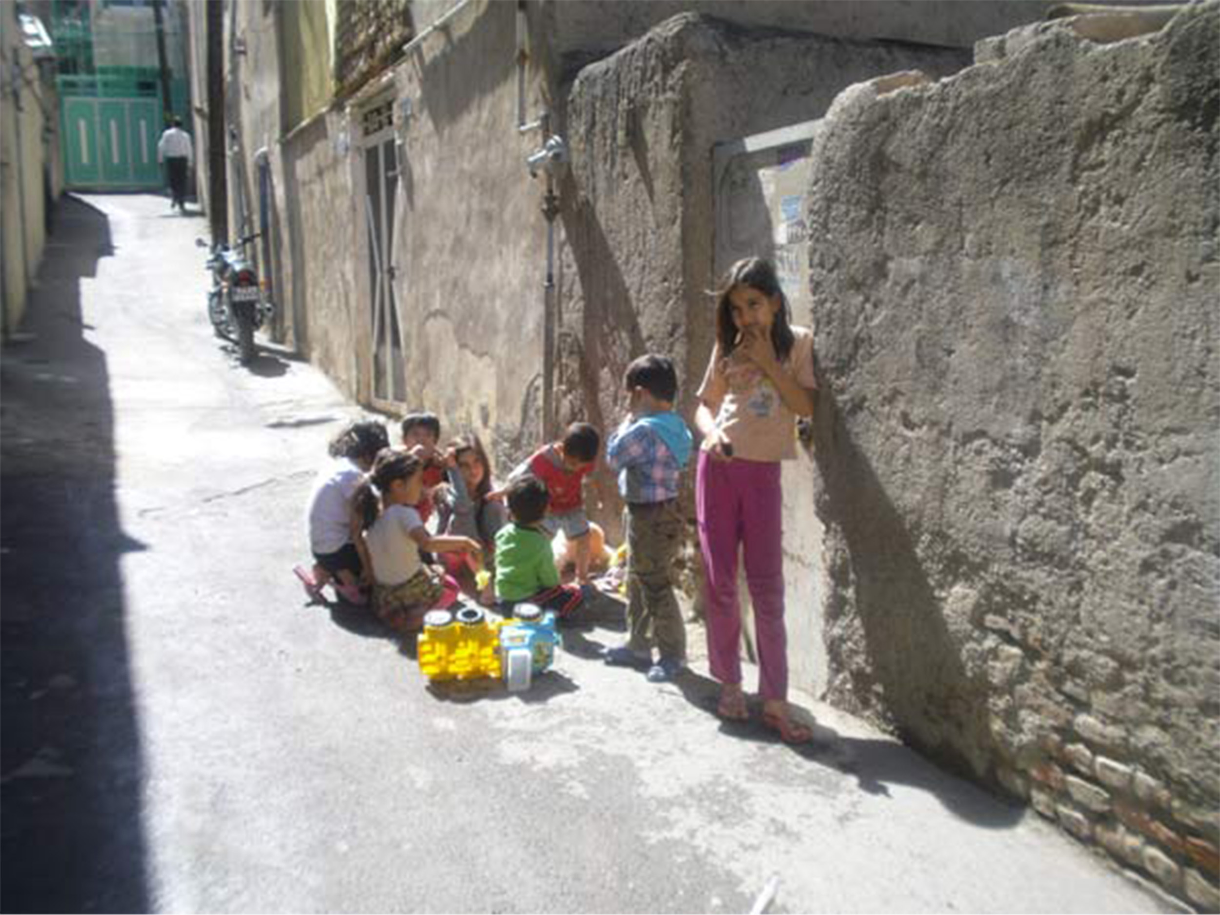
But authorities dismiss these dynamic processes of place-making, the capacity of collaborative construction and the impact of place on their well-being.
In Eslamabad, mosques are the ultimate sign of people’s agency, which residents with similar ethnic backgrounds have built over time. Unlike their houses, which are always in a state of becoming, these mosques are fully constructed and beautifully adorned, a clear indication of residents’ high agency and capacity.
Besides their religious function, they provide a haven for connecting the residents in times of need.

Environment
Designing-in difference
Although residents of Eslamabad have a high capacity for bringing places and community together, the official narrative silences their stories through gentrification.
For many, Eslamabad may be just a tale of a distant place, but the lessons can be applied to many cities around the world, including here in Australia.
Instead of planning cities for the most powerful, urban planners and practitioners should relearn place making from the community, especially the most marginalised ones.
This research is part of the Melbourne School of Design’s 2022 Research Seminar Series on Southern Built Environments. You can register for the next seminar in the series, which focuses on the African Urban Built Environment, on 14 September 2022, both online and in person.
Banner: Karaj city by Ensie & Matthias/Flickr