Sciences & Technology
More fires as our air gets thirstier

After 15 months spent measuring 51,324 trees across 16 hectares, Australia has joined the Forest Global Earth Observatory
Published 3 July 2023
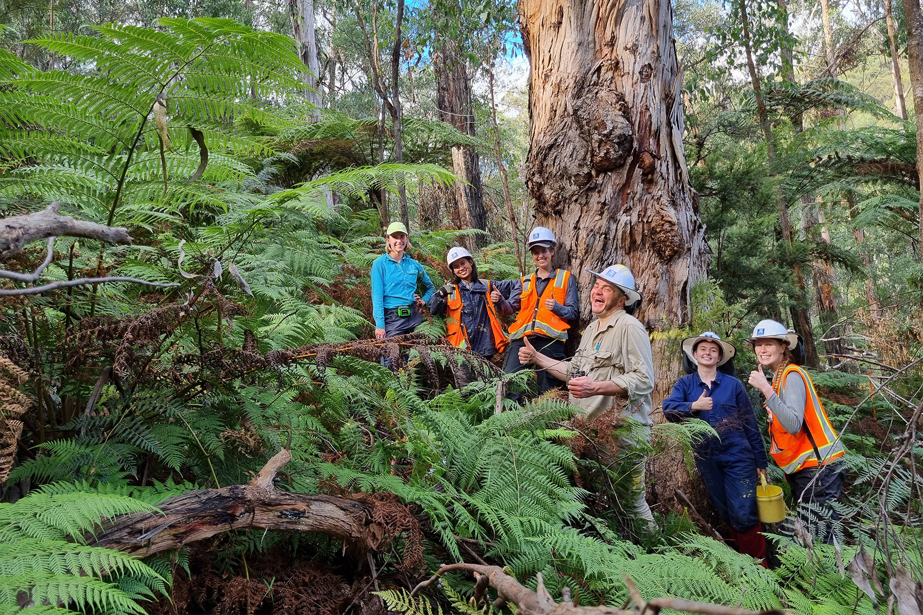
On 30 March, 2023 our field crew – students from the Faculty of Science at the University of Melbourne – gathered around Tree 20-1232, a large mountain grey gum with a big fork in the stem, in a forest east of Melbourne, Australia.
Two of the students measured the tree’s diameter at breast height (DBH), 141.2 centimetres. Two students called out the x- and y-coordinates of the tree.

Another student recorded this information and noted that the tree was a Eucalyptus cypellocarpa and a dominant canopy tree. Another student placed a nail through a hole in a numbered tag and then gently tapped the nail into the tree with a hammer.
Each of the six students then took a turn with the hammer until the nail was firmly lodged in the tree.
And then they celebrated with whoops of joy, a bit of relief and a group photo, because Tree 20-1232 was the last of 51,324 trees that we measured in the Starvation Creek forest dynamics plot, the newest plot in the Forest Global Earth Observatory (ForestGEO).

Sciences & Technology
More fires as our air gets thirstier
ForestGEO is a network of large-scale, long-term study plots coordinated by the Smithsonian Institution that monitor the dynamics of forests around the world.
The Starvation Creek plot is the first of its kind on the Australian continent.
The first ForestGEO plot was established in Panama at Barro Colorado Island (BCI) by research scientists at Princeton University, the Field Museum of Natural History and the Smithsonian Tropical Research Institute.
The work there started in 1981, took three years to complete, and was unlike anything that had been done before – the plot was 50 hectares (half a square kilometre) and the scientists recorded the size, species and location of every tree down to one centimetre DBH (roughly the width of your pinkie finger).
This produced a picture of the forest that was unprecedented in scale and detail – 235,349 trees from 303 species.
It was a boon to tropical forest ecologists, for whom one question had dominated their field for nearly 50 years: “Why do so many tree species co-exist in such a small area?”.

BCI changed the parameters of tropical forest science.
Within a decade new 50-hectare plots were being established across the tropics in southern India, western Thailand, peninsular Malaysia and Borneo. This was the beginning of the ForestGEO network.
The Lambir plot in Sarawak, Borneo was particularly noteworthy because it included more than 1,200 tree species – making it the most species-rich forest ever censused.
At each of these plots every tree in the forest is remeasured every five years. Over the past 40 years, this has generated detailed data on recruitment (new trees), growth and mortality of thousands of tree species and millions of trees across the ForestGEO network.

Sciences & Technology
All the forests in the world from a single layer of cells
In the early 2000s, it was becoming increasingly clear that climate change was beginning to alter fundamental processes in both tropical and cooler, temperate forests, so ForestGEO began to expand into temperate forests, particularly in China and North America.
Because temperate forests have fewer species, the plots were smaller – typically 16-35 hectares, instead of 50.
By expanding the network into the higher latitudes it would be possible to fingerprint how climate change was altering forests – their structure, their composition and their dynamics – at a global scale.
By 2020, the ForestGEO network had 75 large-scale study plots in tropical and temperate forests on every continent in the world..
Except Australia.
Australia’s unique tree flora, overwhelmingly dominated by Acacia and Eucalyptus, and its variable – and at times extreme – climate have created complex forests with complex histories.
But such a detailed large-scale monitoring effort had never been undertaken in Australia.

We began the process of establishing a ForestGEO plot in 2021 as COVID-19 lockdowns were slowly easing. Students who had finished most of their degrees from their bedroom or living room were beginning to look for opportunities to get out into the field.
In consultation with the Victorian Department of Energy, Environment, and Climate Action (DEECA), VicForests and Melbourne Water, we identified an area of mixed-eucalypt forest in the Central Highlands of Victoria, southeast Australia, that was readily accessible, was topographically varied and was thick with tree species. And, best of all, it was simply a beautiful forest.
It ticked all the boxes.

Sciences & Technology
Fossil forests under Antarctic ice
In October 2021, we began a formal survey to demarcate the plot. This involved putting 441 precisely positioned permanent markers across the 16-hectare (160,000 m²) plot to establish a grid of 400 20-by-20 metre sub-plots (called quadrats).
Then, in December that year, we started measuring the trees.
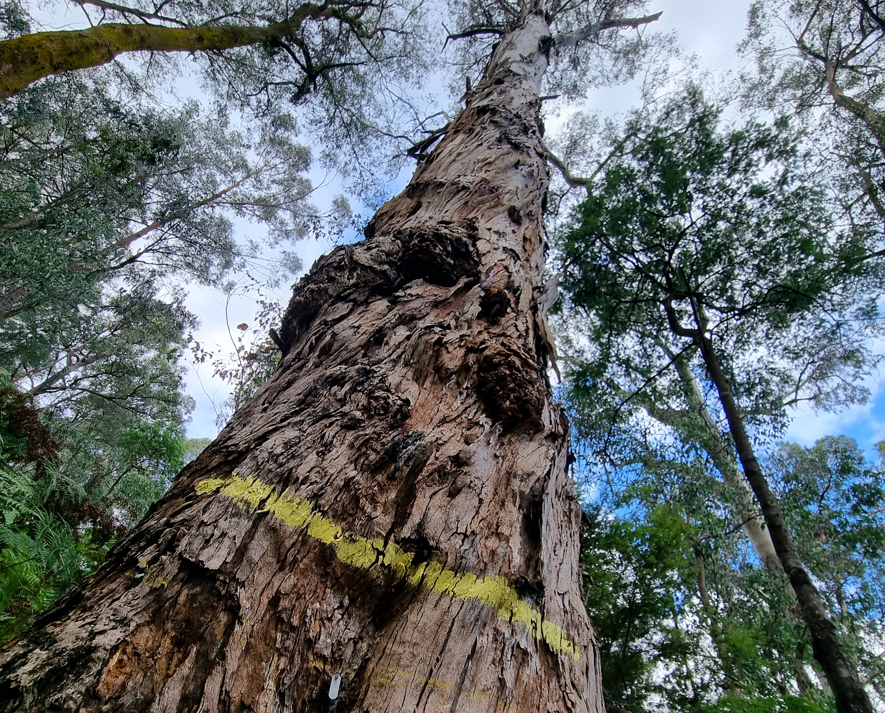
Within each 20-by-20 metre quadrat, we would identify, measure, map, tag and paint a stripe on every tree greater than one centimetre DBH. When we finished one quadrat, we would move on to the next.
We repeated this 400 times over the next 15 months.
The process was slow and repetitive, but it came with some unexpected perks. We spent so much time just standing in the forest day after day that we saw things that we would have never seen otherwise.
The chatty family of galahs that nested in a big messmate in the northeast corner of the plot; the awkwardly graceful yellow-tailed black cockatoos that flew over our heads every few days; the antechinus (a native mouse-like marsupial) that ran across one of the field crew’s boots during a lunch break.

The students in our field crews hadn’t seen much beyond their four walls over the previous two years. Now, there were no walls and they were surrounded by a world teeming with life.
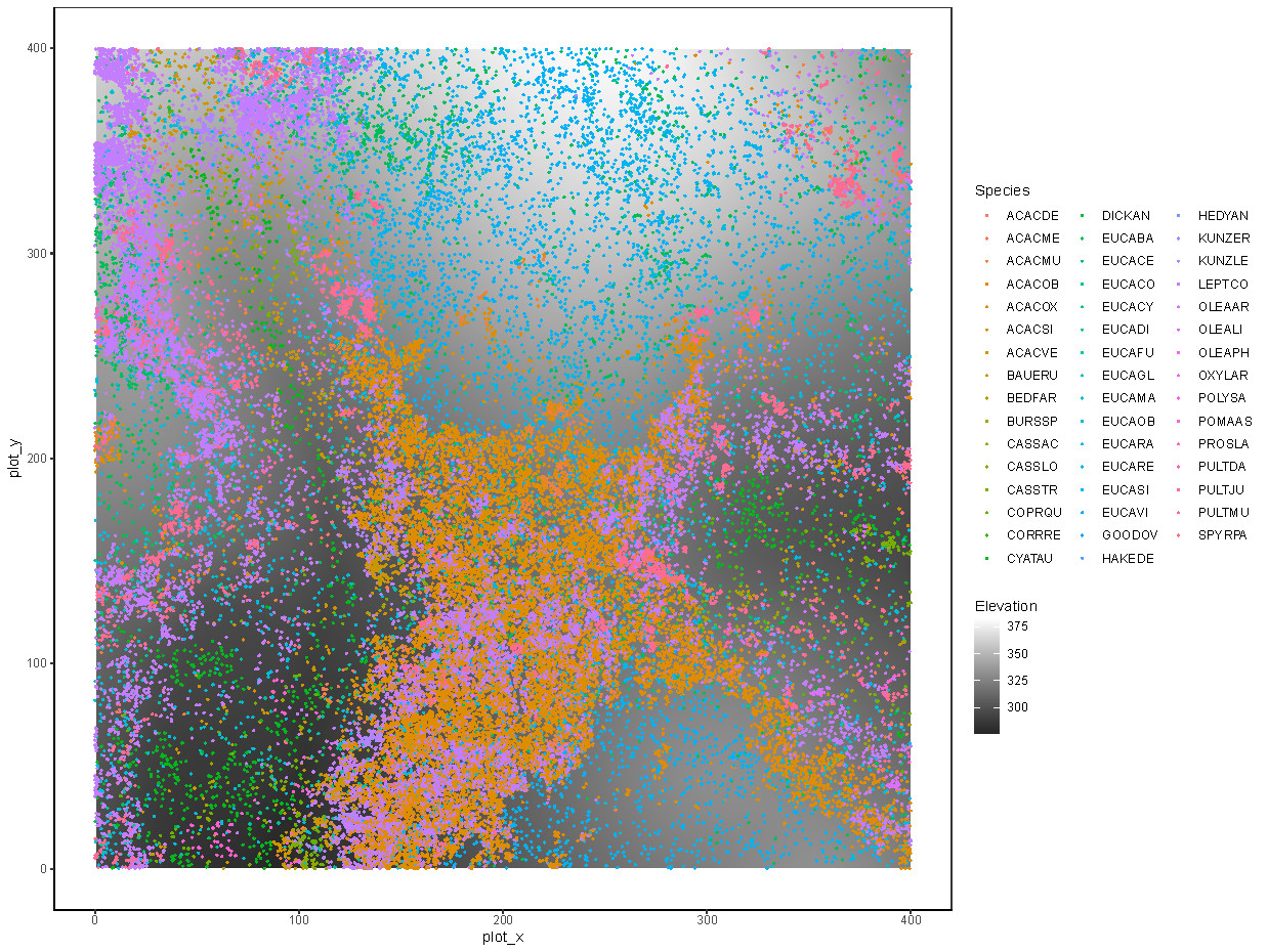
The forest yielded its own surprises. We found 47 species of trees and woody shrubs amongst the more than 51,000 trees that we measured in the plot.
The most remarkable outcome was the incredible richness of the genus Eucalyptus – we found 13 species of eucalypts occurring together.
While this is not extraordinary in Australia – many eucalypt-dominated forests contain half a dozen or more eucalypt species – it turns out that it is extraordinary in a global context.
Of the now 76 plots in the ForestGEO network, only the Lambir plot in Sarawak – with over 1,200 tree species – has more species in a single genus of canopy trees.

This raises an exciting ecological question, “Why do so many eucalypt species coexist?”, which echoes the original question that motivated the establishment of the first ForestGEO plot in Panama more than 40 years ago.
Over the coming months, years and decades researchers and students will be spending time at Starvation Creek exploring this and other questions about how these remarkable forests work.
Students from the University of Melbourne have already begun to use this unique resource on teaching field trips. And every five years, we’ll head back out to remeasure the trees and maybe have lunch with an antechinus or two.
The Starvation Creek census was financially supported by the University of Melbourne’s Faculty of Science and the Smithsonian Institution’s ForestGEO.
Banner: The field team (L-R) Gabrielle Miller, Thazin Saw, Eloise Welsh, Marty Lockett, Rebecca Rasmussen, and Ella Hellessey. Picture: Ella Hellessey