Before it was streets and suburbs, Melbourne was a rich landscape of forests, swamps and grasslands. Our new Map of the Month is rebuilding it for the first time – tree by tree
Have you ever wondered what your Melbourne suburb looked like before all the streets and houses?
For the expanding outer suburbs of Melbourne we have photos, satellite images and living memories. But what about the city's older inner suburbs built well over a century ago?
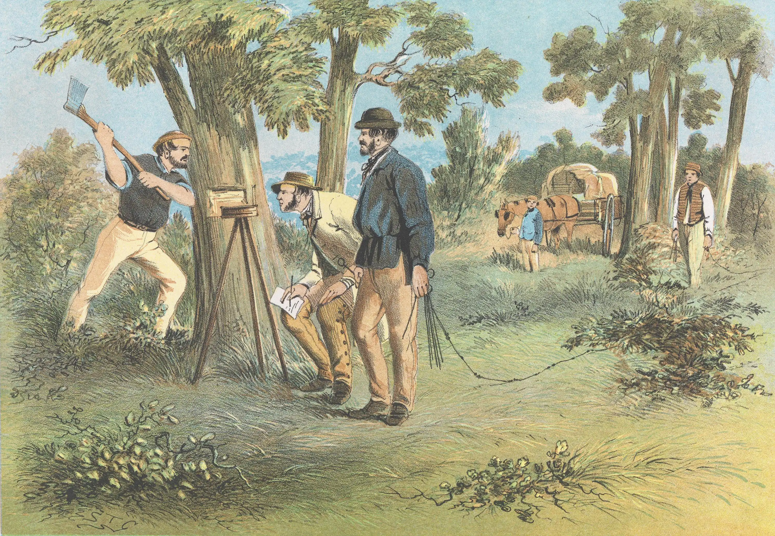
Colonial surveyors marked trees to partition land for sale to British settlers. Picture: S. T. Gill, Surveyors (1865), National Gallery of Victoria, Melbourne
In doing so, they marked the course of creeks and rivers, locations of swamps, the routes of early roads and the nature of the soil.
And, luckily for our research, they also marked trees to determine the corner of allotments.
There, in this 180-year-old script, is the species composition of Melbourne’s original urban forest. Over the last 15 years, we’ve worked to try to reconstruct these landscapes.
And now, we have our first ecological view of 1840s Melbourne.
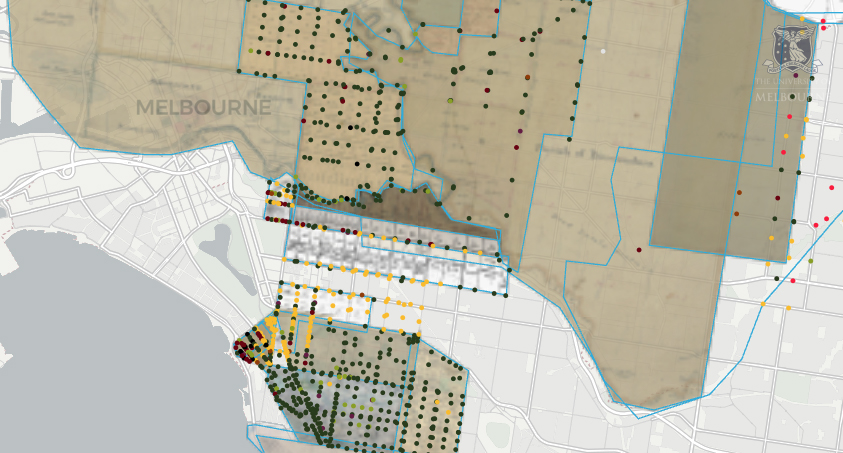
Each dot marks a tree recorded in the 1800s surveys. Hover (or tap) a dot to see the tree species, survey date and source map.
Data: Public Record Office Victoria and the Victorian Department of Energy Environment and Climate Action Original survey maps: Henry B. Foote (1855, 1853, 1851, 1853, 1854), R. Russell (1855), Unknown (Undated, Undated), Robert Hoddle (1837, 1840, 1849, 1848, 1845, 1840, 1843, 1840, 1842), Charles C. Horrell (1849, 1848), T. H. Nutt (Unknown, 1842, 1842) Researchers: Professor Nick Williams and Associate Professor Amy Hahs Map: Dr Emily Fitzgerald, Melbourne Data Analytics Platform (MDAP), Dr Patricia Torquato, Tree Dimensions
While this kind of reconstruction has been done across North America, this is the first time that all the pieces of this ecological puzzle have been brought together for Melbourne.
To do this, we needed not only the information in the maps, but complex mathematical modelling to extrapolate the data and determine the likely density of trees in the area.
We overlayed the PROV maps over current-day Melbourne. And the results contain some incredible detail.
The original tables and maps recorded trees by their old common names, not the species names we use now. But by taking those old names and reading them against the native vegetation still growing in Melbourne, ecologists can pin down exactly which species the surveyors saw.
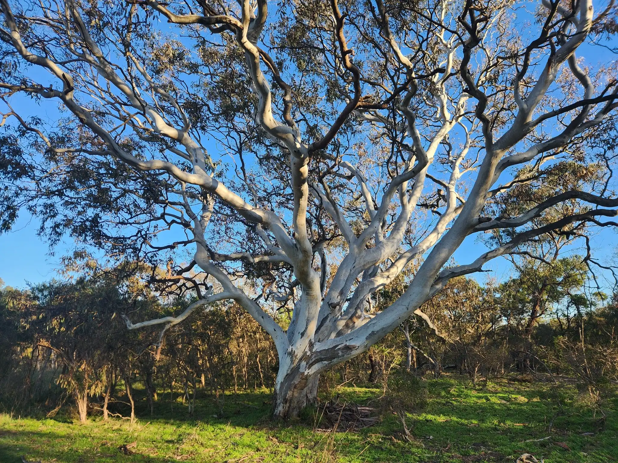
"Gums" were the most common tree listed in the inner suburbs.
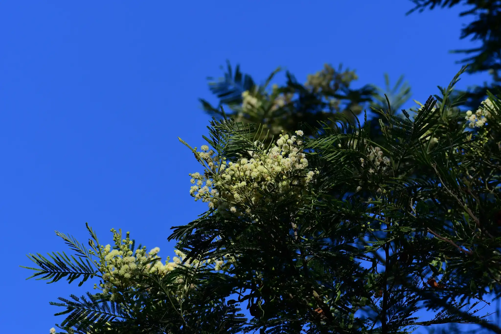
The early forests of eastern Melbourne, on the other hand, were denser and more diverse.
The old lists feature names like "Stringybark", which could be one of many eucalypts with thick, fibrous bark that you can pull off in long strips, "Wattle" (likely Acacia mearnsii)andother common Acacia trees like "Blackwood" (Acacia melanoxylon) and "Lightwood" (Acacia implexa).
This map is divided by underlying rock types and elevation above sea level, as these capture major trends in soil and growth conditions to better predict species and tree densities.
Data: Public Record Office Victoria and the Victorian Department of Energy Environment and Climate Action Researchers: Professor Nick Williams and Associate Professor Amy Hahs Map: Dr Emily Fitzgerald and Dr Noel Faux, Melbourne Data Analytics Platform (MDAP), Dr Patricia Torquato, Tree Dimensions
Naturally, our reconstructed forests are more accurate for the areas with more marked trees, but this map offers our best picture yet of these ancient forests.
Witness and remnant trees
If we look at our first map, some of the original marked trees – otherwise known as 'witness trees' – are in curious locations .
There was a pair of large "Box" trees where The National Theatre in St Kilda now stands, and a row of "Gums" running through the current path of the Birrarung-Yarra River between the inner-city suburbs of Cremorne and South Yarra.
Despite much searching, we couldn’t find any witness trees still standing in their locations.
This is perhaps because the surveyed trees were used as markers for new roads – another pattern that emerged from our maps.
But remnant trees – which are trees that predate European colonisation or have grown naturally from original forests – are still common in some areas.
Gresswell Forest in the north and Valley Conservation Reserve in the city's south both have good quality remnant trees, which gives us a glimpse into the forests that once filled the landscape.
Forgotten woodlands and lost grasslands
Historically, Greater Melbourne was not only made up of forests of Gums and Box trees.
Tree density drops in the western and northern areas of our map, but they weren't empty.
Descriptions of these open plains in the north including in Pascoe Vale South and Coburg tell us these plains extended almost to where our modern city now stands.
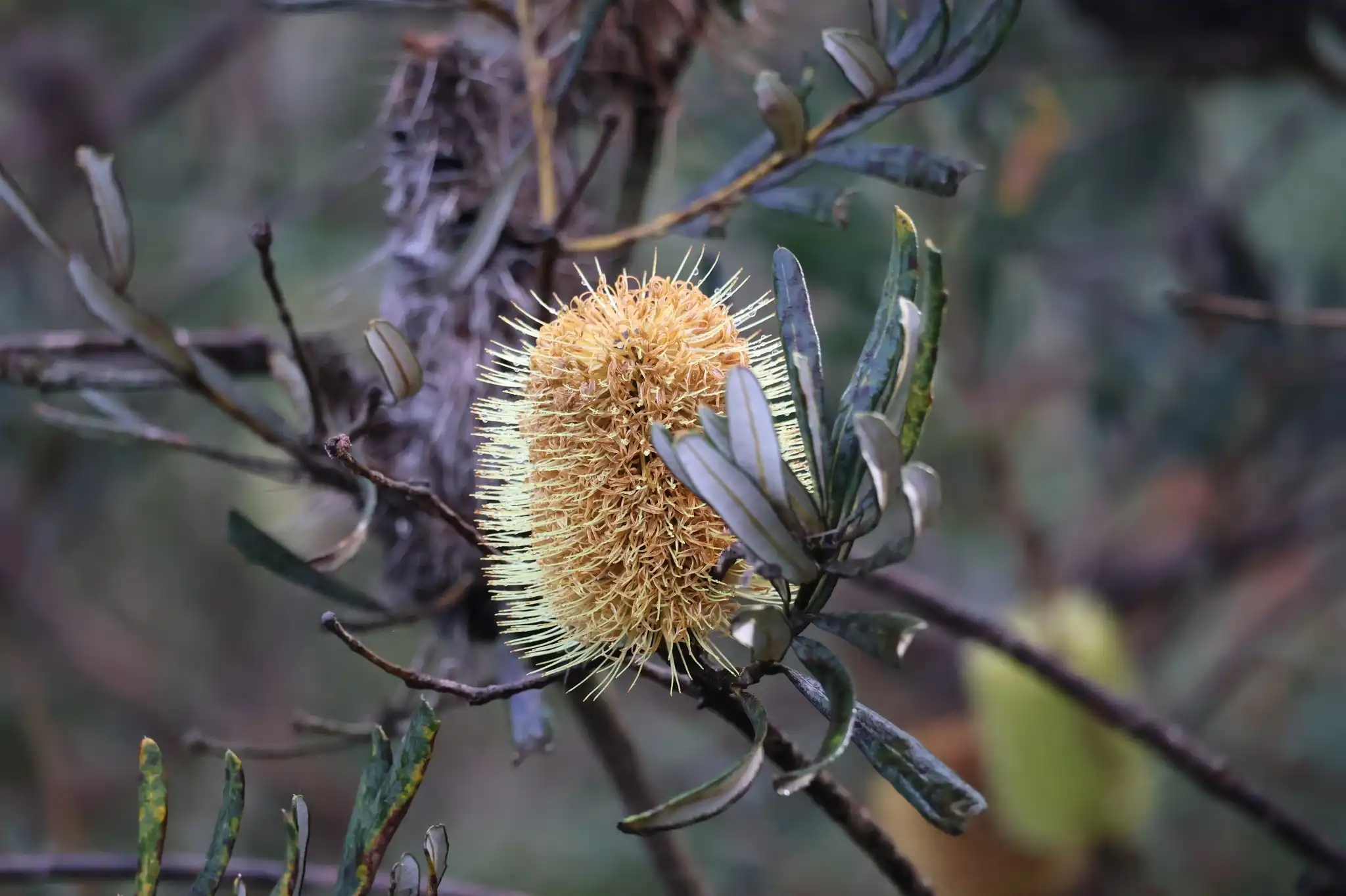
Silver Banksias used to be abundant in the west, but are almost completely absent now. Picture: iNaturalist/harveylam
River Red Gums used to dominate much of Melbourne's landscape. Picture: iNaturalist/Ossifrage94
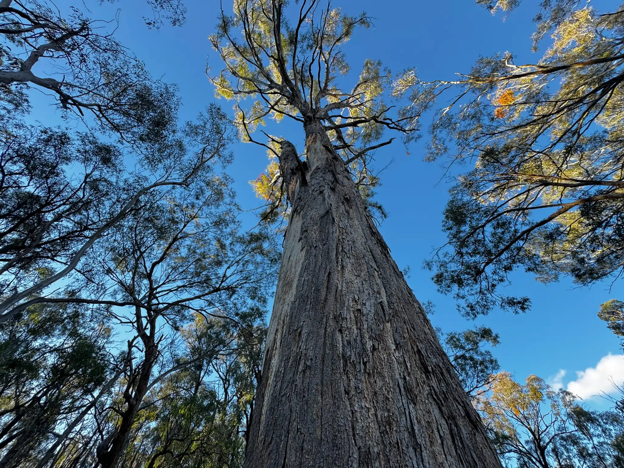
Yellow Boxes were often cut down for firewood and timber due to their tall, straight trunks. Picture: iNaturalist/spookpadda
The early forests of eastern Melbourne were dense and diverse. Picture: iNaturalist/ossifrage94
1 / 4
Then there are the Forgotten Woodlands of the west. The trees listed as “Honeysuckle” in most cases refer to Silver Banksias (Banksia marginata).
These grew in less dense areas of the map. But today, they are totally missing.
There are still some rare examples of remnant Silver Banksia trees away from the city in western Victoria, but the large numbers of them that once grew alongside Drooping Sheoaks now only exist in tiny, isolated pockets.
We have presented our preliminary results to Traditional Owners, and we're now working to ensure the knowledge of the Wurundjeri, Bunurong and Wadawurrung peoples are an integral part of our future research.
Where conditions allow, we hope to replant these same species in their original locations, returning a familiar ecology to this land.
For now, these maps allow us to take a look back 200 years at Melbourne's lost rolling grasslands and native woodlands.
Map of the Monthis a project from the University of Melbourne (Melbourne Centre for Cities, Melbourne Data Analytics Platform and Pursuit) using maps to spark important policy conversations across metropolitan Melbourne. Academics, community leaders and government representatives from across Melbourne contribute to the maps and accompanying stories.