


Where has our summer gone and will it come back?
Australian summers can be fickle and hard to predict - and that's without the extreme weather resulting from climate change

Published 12 January 2024
Back in September 2023, the Bureau of Meteorology (BoM) declared an El Niño event.
We'd already had three soggy years of La Niña conditions, so many Australians started thinking about BBQs and beach days, looking forward to a long, hot summer.

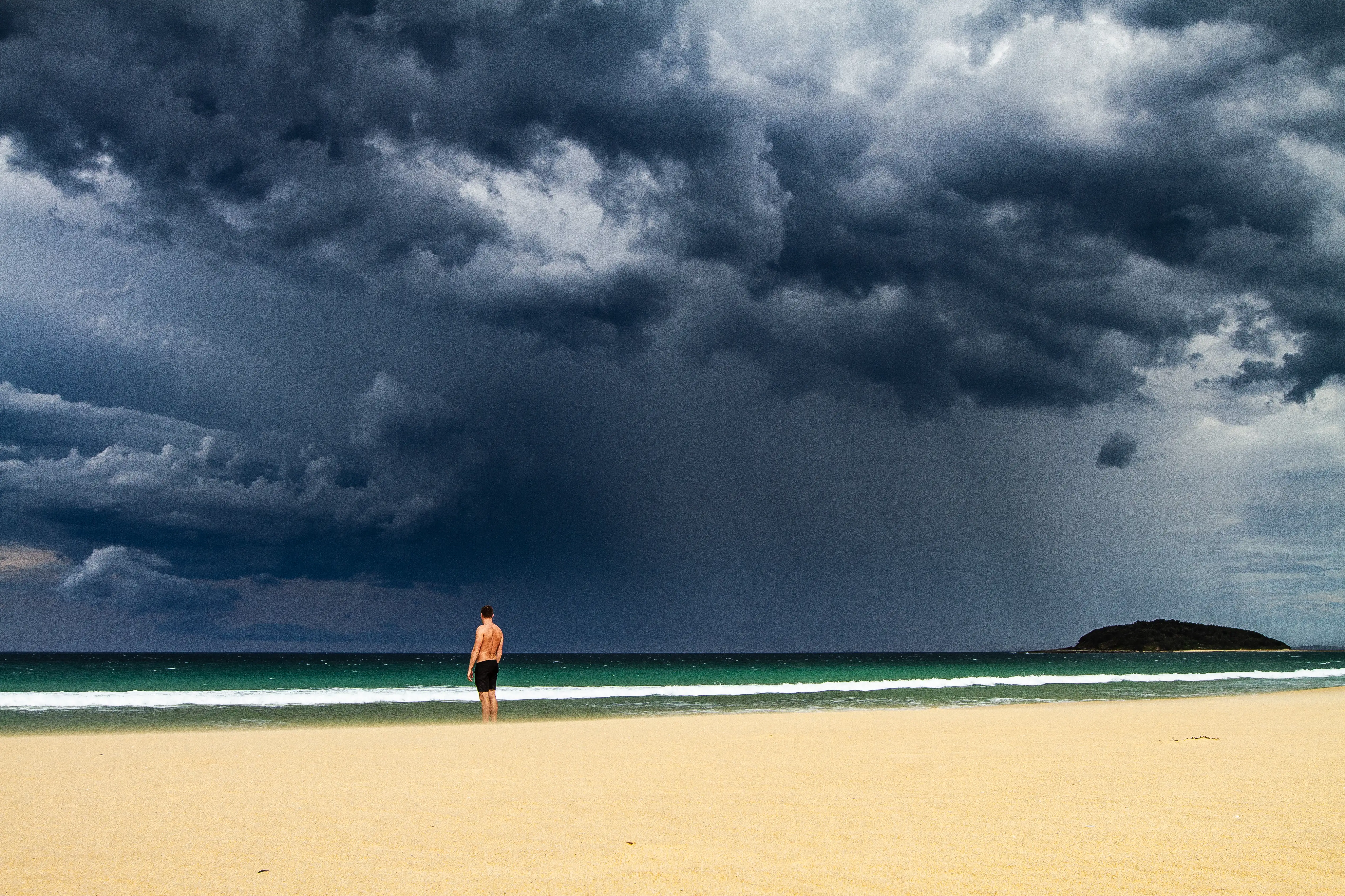
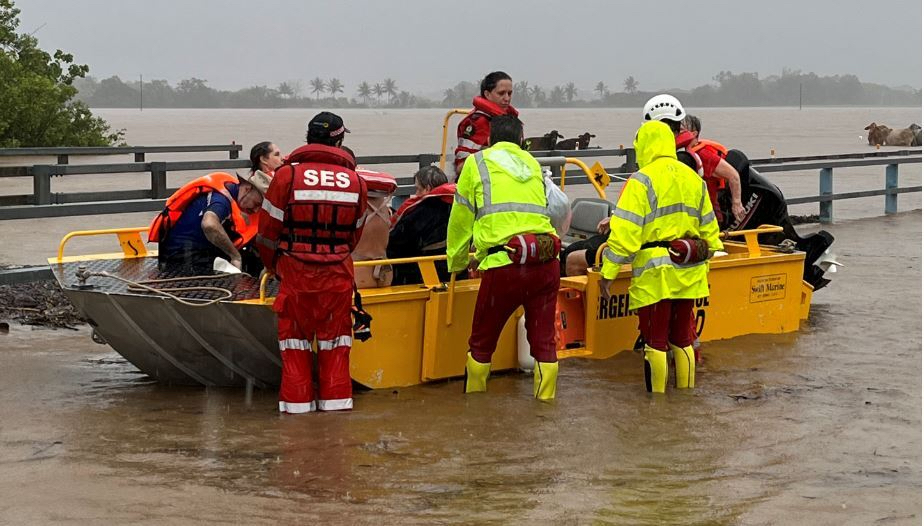
But the start of that summer didn't match expectations. Many parts of the continent experienced a drenching with severe floods in several states. It's something we've seen repeated in a couple of years since then.
In 2025, while Perth sweated through its hottest first day of summer on record – New South Wales, Victoria and Tasmania experienced their coldest start to summer in decades with snow falling in some alpine regions.
So, what happening to our summers? And are they likely to get more extreme?
Why do we expect dry conditions when we have an el niño?
El Niño events are characterised by warmer than normal seas in the central and eastern tropical Pacific and cooler conditions in the western Pacific nearer Australia.
This is related to a weakening of the easterly winds near the equator called the trade winds.
When we have these conditions, we also see a shift in weather patterns with low pressure moving further east in the Pacific and a tendency for higher atmospheric pressure nearer Australia.
High pressure is associated with air sinking rather than rising in the atmosphere, and this promotes clear skies and drier weather.
In contrast, when we have low pressure, air rises and cools causing condensation of water vapour, cloudy skies and rainfall.
As El Niño events can persist for many months, typically starting to form in late winter and decaying the following autumn, the shifts in predominant weather patterns can lead to persistent wetter or drier conditions in different parts of the world.
For example, El Niño is often blamed for floods in parts of South America and East Africa, and for drought in Australia and Indonesia.
But sometimes it feels like it rains in Australia when we have an el niño
Although El Niño events mean a higher-than-normal chance of a dry spring in parts of Australia, this does not mean that all El Niño events will always be drier than normal.
It is a bit like ‘loading the dice’ to get an increased chance that dry conditions will occur, rather than a guarantee of dry conditions in all cases.
Additionally, the relationship between La Niña and Australian rainfall is considerably stronger than the effect of El Niño on rainfall.
While La Niña events are pretty reliably wet, El Niño events can often be wet or dry.
Also, the El Niño relationship to the Australian climate tends to be strongest in spring, and the influence is somewhat weaker by summer.
Given these nuances, there perhaps could have been somewhat less of an expectation of a dry summer by keen beachgoers.

Sciences & Technology
Explaining Melbourne’s crazy but predictable weather
There are other influences on Australia’s climate beyond El Niño too.
There's the positive Southern Annular Mode which is associated with moist onshore flow from the Tasman Sea and rainy conditions in eastern New South Wales and Queensland.
We have also seen remarkably high sea surface temperatures around eastern Australia. This is provides moisture and promotes instability that can lead to rainfall.
Is it harder to predict extreme rain events?
Weather forecasting has progressed in leaps and bounds, so we now have an expectation that major rain events will be reasonably well predicted in most cases.
On timescales of up to about seven to 10 days, rainfall events, are generally very well forecast and the quality of weather forecasting has greatly improved since the 1980s.
Seasonal outlooks – that attempt to predict the probability of very wet or dry conditions over lead times of about one to three months – are also improving.
In summer, more of our rain falls in localised storms and the exact locations and paths these storms can be harder to predict, even a few hours in advance, let alone days, weeks or months.
For seasonal prediction, this poses a big challenge as smaller weather systems, including thunderstorms, aren’t strongly related to climate influences like El Niño.
As a result, we see greater limitations in seasonal prediction around summer when thunderstorms occur than around winter.
Sciences & Technology
Climate is warming faster now than last 2000 years
Predicting our future summers
Australia's weather is becoming more extreme.
We've seen extreme rainfall, heatwaves and hailstorms. They all act as a reminder of how variable and fickle Australia’s summer weather can be.
One thing we can be confident of is that Australia will see more extreme weather and our future summers will continue becoming hotter as global warming continues.
