Sciences & Technology
Q&A: 4 things you need to know about Victoria’s earthquake
A high precision seismic network is now able to detect about 400 earthquakes every year in Victoria’s Gippsland region, providing key information to protect people and infrastructure
Published 8 February 2022
The National Seismic Hazard Assessment of Australia identifies the southeast corner of Australia as a seismic hotspot – with a magnitude 5.0 or greater earthquake occurring roughly every seven years on average in Victoria.
The 1989 magnitude 5.6 Newcastle earthquake in New South Wales exemplifies the expected damage from such an earthquake near an urban centre.

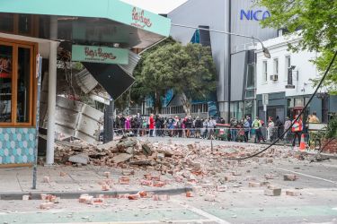
The most recent reminder of this activity in Victoria was the magnitude 5.9 earthquake in remote Woods Point on 22 September 2021, making it the largest recorded earthquake in Victoria since European settlement.
It also occurred on a previously unmapped fault line.
Woods Point reminds us of the importance of detecting faults and mapping them to determine whether they are active and are potential sites for earthquakes.
This is why we have developed and expanded the University of Melbourne’s seismic monitoring in Victoria into probably the best performing regional continuously operating seismic network in Australia.

Sciences & Technology
Q&A: 4 things you need to know about Victoria’s earthquake
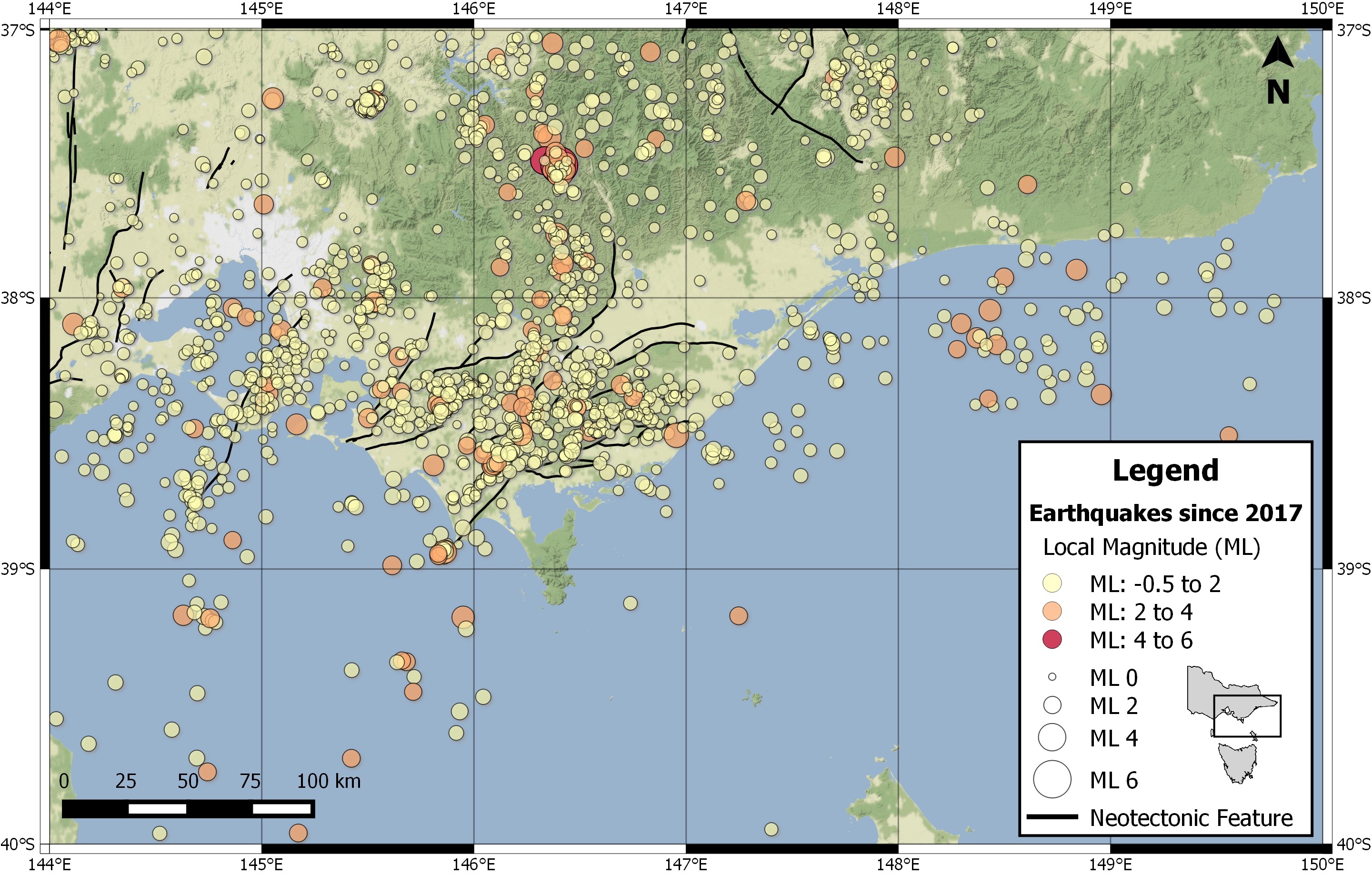
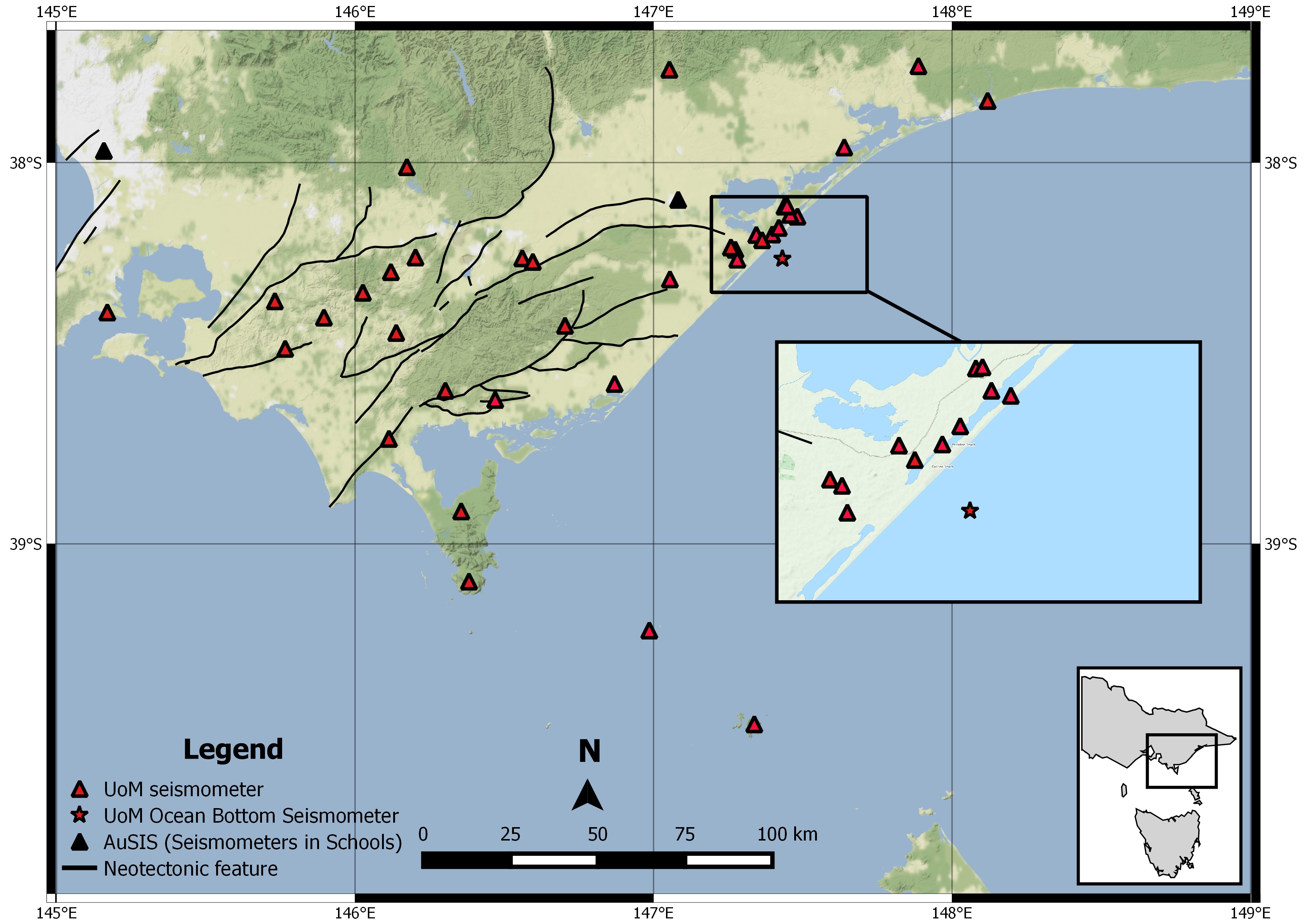
The earthquakes in southeast Victoria are likely occurring on pre-existing earthquake faults, a subset of which is identified in Australia’s Neotectonic Features Database based on indirect geological evidence. Neotectonic Features are earthquake faults that have been active some time in the last eight million years.
The origin of some of these faults can be traced back to about 160 million years ago when Australia started splitting from Antarctica during the breakup of the Gondwana supercontinent. Since then, these faults appear to have been reactivated by several plate tectonic events at different times.
Though it remains incomplete – as most recently demonstrated by the occurrence of the Woods Point earthquake – the Neotectonic Features Database reveals a maze of faults beneath Victoria.
This includes significant faults close to urban centres like the Selwyn Fault that cuts into the Mornington Peninsula and the Muckleford Fault located 20 kilometres east of Ballarat.
Considering only their dimensions, these two faults are theoretically capable of hosting magnitude seven earthquakes, and are a stark reminder of the importance of better understanding the fault lines and seismic activity throughout the state.
The key to improved monitoring is the ability to precisely detect and locate small earthquakes beneath the threshold that humans can feel, because these occur much more frequently than larger events, and indicate which faults are active.
The University of Melbourne began monitoring earthquakes in Victoria in 2012 following the magnitude 4.9 Thorpdale earthquake that we have investigated in detail.

Sciences & Technology
Earthquakes that talk to each other
Since then, we have been developing a high-performance seismic monitoring network covering the Gippsland region to detect and locate earthquakes in unprecedented resolution.
This network uses seismometers – sensors that can record even the slightest ground vibrations that result from energy passing through layers of the earth from an earthquake (seismic waves).
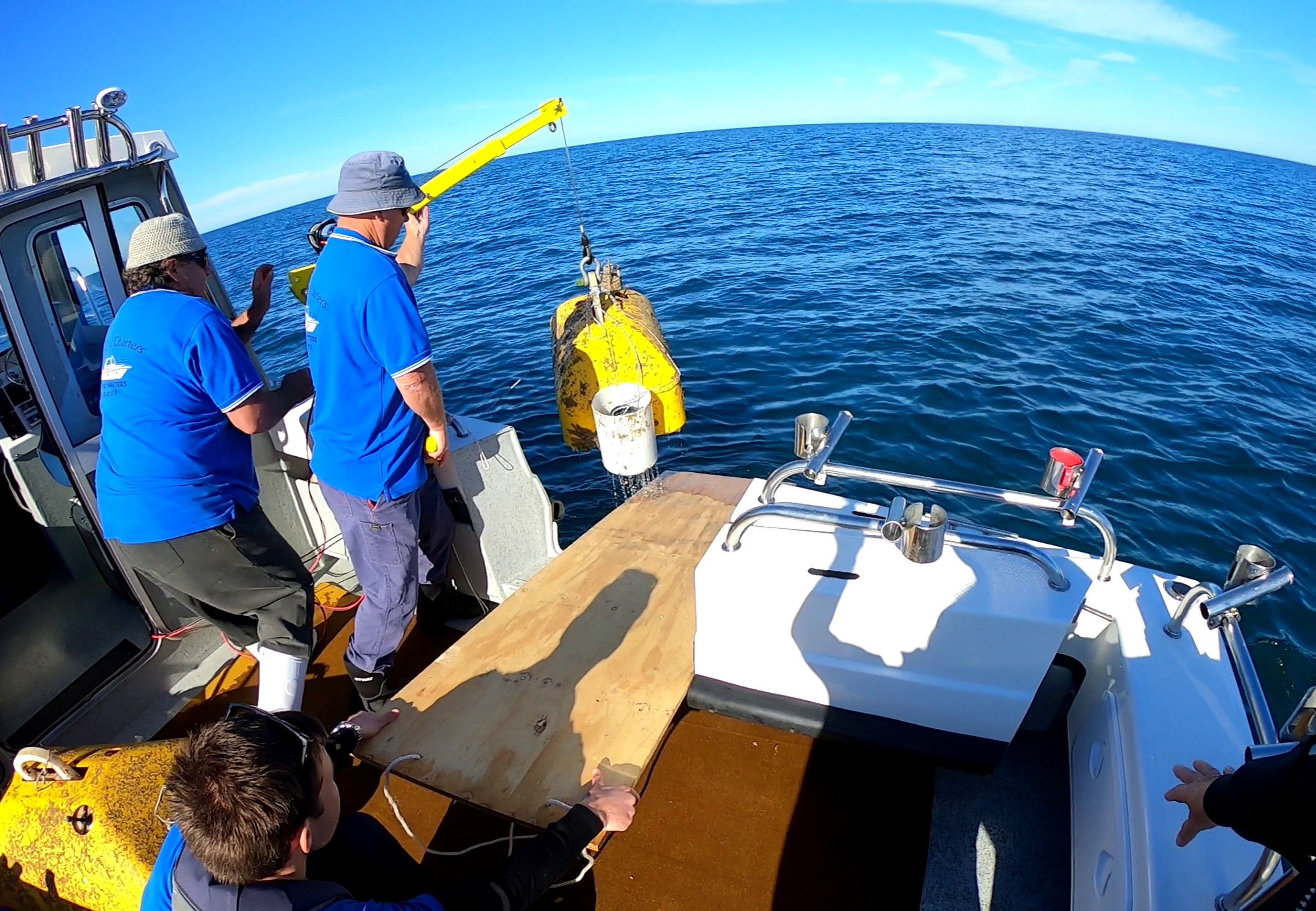
Embedded in our network are different types of seismometers – sensors that sit on or near the surface in boreholes 10 metres to 1000 metres deep and those that sit on the ocean bottom called Ocean Bottom Seismometers.
These instruments are located on land, on island sites like the picturesque Deal Island and beneath Bass Strait, with most sensors transmitting live data to our servers at the Parkville campus.
When designing an advanced seismic network like ours, there are several considerations.
For example, having seismometers as close as possible to an earthquake helps determine its depth accurately. In addition, having 360˚ seismometer coverage around that event helps accurately determine its epicentre – the point at Earth’s surface directly above where the earthquake occurs in the subsurface.
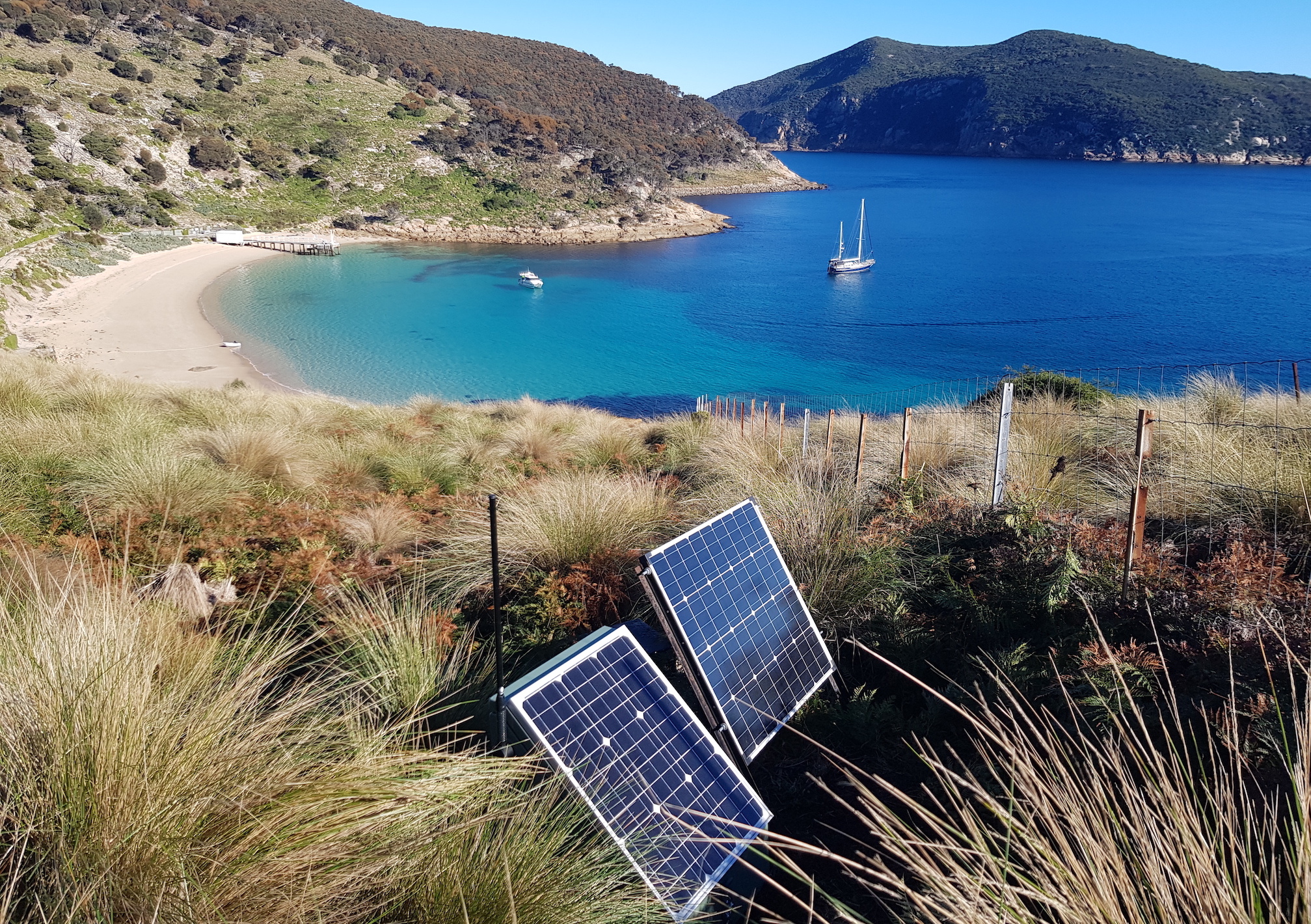
In addition, we prefer to install seismometers on hard bedrock sites, as these transmit seismic waves more efficiently and with little loss of energy compared to seismometers located in “softer” soil sites that weaken seismic signals and sometimes generate undesirable levels of interfering noise.
Having mobile phone coverage is also a consideration, as the ability to transmit live data enables near-real time analysis of earthquakes or other events that generate seismic waves.
For example, our instruments recorded ground vibrations from the recent demolition of chimneys at the Hazelwood Power plant with an equivalent earthquake magnitude of 1.6.

Sciences & Technology
Forecasting landslides from space
In the last four years, with the support from our funders, we have developed new capabilities including deploying high-frequency, shallow marine Ocean Bottom Seismometers, and established operational benchmarks to optimise seismic monitoring both on land and in shallow marine environments.
As a result of this work, earthquake detections in eastern Victoria have increased to more than 400 a year from about 150 a year before 2017, because we now have more stations closer to smaller events recording signals that previously went undetected.
We are also detecting some events at magnitudes as small as -0.5, which are tiny centimetre-scale earthquake ruptures in the crust – earthquake magnitude is measured on a scale extending below zero.
These low-energy events correspond to tiny centimetre-scale earthquake ruptures in the crust.
We have also reduced the threshold at which all earthquakes in the network are detected from magnitude 1.2 before 2017 to 0.5 today. We can more precisely locate earthquakes to within less than one kilometre, compared to earlier location uncertainties of up to 10 kilometres.
We believe these statistics put our seismic network ahead of any other regional-scale network in Australia.
We recently launched an open-access cloud-based web application on the AuScope Virtual Research Environment store to inform decisions about seismic network design, developed through a collaboration between the University of Melbourne and CSIRO.

Sciences & Technology
When Central Australia slipped and trembled
In addition, our preliminary work on earthquake physics suggests that earthquakes of magnitude less than about 2.5 in Gippsland radiate about 10 per cent more seismic energy than typical intraplate earthquakes, which naturally translates into slightly greater seismic hazard.
It isn’t known, however, if larger earthquakes that may cause significant damage will radiate energy in a similar manner to these smaller events.
Interestingly, the Woods Point earthquake of magnitude 5.9 appears to have caused less damage than expected, although this may be partially explained by its depth of about 12 kilometres.
This potential for small earthquakes to radiate slightly more seismic energy highlights the need to further understand earthquake behaviour at all magnitude ranges in Gippsland so that we can ensure the safety of fast-growing urban centres and critical infrastructure.
For example, the new insights on seismicity we have obtained from continuously accumulating volumes of high-quality seismic data is now being used to inform future planning for the CarbonNet Project, a proposed world-class shallow marine carbon dioxide sequestration site being investigated for commercial-scale operations.
The new technology and research capabilities we are developing to monitor seismicity will lead to a better understanding of earthquake processes, providing benefits to society and industry alike, and help ensure safer living spaces for Victorians.
Financial assistance to carry out research described in this article is provided through Australian National Low Emissions Coal Research and Development (ANLEC R&D) which is supported by Low Emission Technology Australia (LETA) and the Australian Government through the Department of Industry, Science, Energy and Resources.
Funding for developing seismic monitoring infrastructure is provided by the Australian Government through the Education Infrastructure Fund and administered and coordinated by CO2CRC. AuScope provides partial funding to support operational activities.
Banner: Shutterstock