Politics & Society
Is Melbourne really a 24-hour city if public transport stops?


Maps tell stories, help discovery, provoke discussion and can change the way we understand our world. Welcome to Map of the Month


Published 11 July 2024
Maps are one of the most fundamental and universal tools that our species has developed.
The history of mapmaking can be traced back more than 5,000 years. They are a cornerstone of wayfinding. They have provided an essential means for navigating natural and built environments alike for thousands of years.
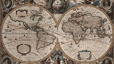
Maps convey important information and save lives, not least in the midst of crises and disasters. And now, they are being enhanced as the latest advances in technology introduce augmented reality, real-time data streaming and AI-powered geo-sensing.
These technologies have changed the science – and art – of mapmaking.
Mapping technologies we now take for granted enable extraordinary things. Saroo Brierley’s story captured the world’s imagination after he became lost on an Indian train aged five, and 25 years later used Google Earth to navigate his way home.
The 2016 film depiction of his journey, ‘Lion’, was an international sensation.
For urbanists like us, maps have always been an essential tool to grasp the ever-changing context we work in, and a go-to when seeking to communicate the intricacy of the built environment.
Politics & Society
Is Melbourne really a 24-hour city if public transport stops?
For urban dwellers, maps are both handy devices and pathways to discovery – we might use them to find a new park, café or home, but also to understand key issues facing our city, like housing inequality, food deserts and mobility injustice.
As platforms for storytelling, maps bridge the experience of one with the experience of many.
Participatory mapping projects let us to understand spaces from different perspectives.
Your Ground, for example, uses crowdsourced data to map out women’s and non-binary folks’ perceptions of safety across cities in Victoria and New South Wales.
Maps help us make (spatial) sense of otherwise abstract concepts. Pointing out the statistic that 30 per cent of the 734 square kilometres surface of Singapore is covered by vegetation is not the same as seeing a sprawling canopy of green dots across the Lion State.
Maps help balance what we debate and discuss: they provide spatial scale and orientation.

Critically, maps are a powerful instrument for storytelling.
Who of us didn’t regularly flick to J.R.R. Tolkien’s annotated map of Middle-Earth to make sense of Frodo’s journey in The Lord of the Rings.?
Maps help us chart ways to move across spaces, but each map only tells part of the story.
Anyone who has walked between metro stations in London or Tokyo would know how different the locations of the stations are on maps of the famed London Tube or Tokyo Metro when we compare them to the actual walking distance between those stations.
Compare a street and a Tube map, and you might see that a short walk is quicker than a packed train. Maps work in tandem and should perhaps never really be read by themselves.
The stories maps tell can expand our imagining of the places we live in, and spark curiosity that can drive change. This is where our ‘Map of the Month’ series on Pursuit comes in.
These maps not only tell us fun facts about Melbourne but, when combined with deep insights from key researchers, explain the opportunities and challenges we face to become a more liveable and resilient city.
The Map of the Month pilot project urges us to listen to the stories that maps tell. It’s inspired by – and named after – a mapping project in greater Johannesburg.
For ten years, the Gauteng City-Region Observatory (GCRO) has released a metropolitan map every month to generate public, policy and industry debate.
With friendly advice and backing from our GCRO colleagues in Johannesburg, we have moved the location to Melbourne, Australia, while seeking to retain the ethos of Map of the Month – communicating clearly, beyond an academic audience, through the medium of a provocative map.
Making a map a month of Melbourne is a tool to advocate for Melburnians, and those who look at our city from afar, to develop a better ‘metropolitan imagination’ of the complex and vast reality of this fast-growing urban settlement.
Our journey started with a map about the bumping spaces that make up our metro’s community infrastructure, and a look at Melbourne’s sweltering streets.
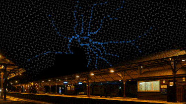
We took a detour through the popular concept of the 20-minute city, and then crossed town to a pair of stories to look at the experience of Melbourne's night workers and access to 24-hour public transport (or not).
Next, we turn will take a left turn to the left field and ask ourselves if Melbourne is really a city for dogs.
This is a cartographic adventure of Melbourne – you may discover a surprising fact or two about this great and complex city we inhabit.