Earthquakes: The lessons learned
Earthquake expert Associate Professor Mark Quigley on preparing for and recovering from earthquakes
VOICEOVER
This is Up Close, the research talk show from The University of Melbourne, Australia.
ANDI HORVATH
Hi. I’m Dr Andi Horvath. Thanks for joining us. Today we get up close to, but at a safe distance from, earthquakes. We live on a dynamic planet in which the frequent rubbing of tectonic plates can often lead to devastating consequences for populated areas. We often hear about when we might expect the next big one, but how reliable is earthquake prediction? Given recent disasters in Japan, China, New Zealand and elsewhere, what have we learned about how to prepare for and recover from the almost certainly inevitable.
Our guest on this episode is University of Melbourne, geomorphologist and earthquake specialist, Associate Professor Mark Quigley. Mark survived the devastating 2010 and 2011 Canterbury earthquakes in New Zealand but unfortunately, lost his home to liquefaction. More about that later.
Through his experience, Dr Quigs, as he’s known, has also gathered insight into how best to communicate earthquake risks and issues to the public. Mark, welcome.
MARK QUIGLEY
Hello.
ANDI HORVATH
When we see earthquake zones, we are amazed at the amount of force that bends bridges, levels large structures and topples or even subsumes landscapes. What’s happening below the earth's surface, or even the ocean’s surface.
MARK QUIGLEY
Yeah, well we know we know we live on a very dynamic and constantly changing planet. We can measure it in fact. In the Australian context, we know that our plate moves about six centimetres per year in a north, northeast direction about the same speed your fingernails grow and we can measure plate motions all around the planet and it turns out these tectonic plates are moving in different directions at different speeds so we know that the process of subduction, which pulls the plates forward, is a major process that drives plate motion. We also know that plates are moved by pulling apart at plate boundaries. New material is coming up from the mantle and the topographic forces associated with that cooling, push the plates apart and we also know that convection is going on in the mantle beneath us. So really, the earth is like an engine that’s trying to lose heat; that’s it main mission and plate tectonics is an efficient way of the earth actually losing heat over geologic time.
ANDI HORVATH
So this is a jostling of liquids and solid plates?
MARK QUIGLEY
Yeah, well the plates themselves are tens of kilometres thick. Their thinnest where we have new oceanic crust forming; they’re thickest beneath big mountain belts like the Himalayas, the continental crust, that is, and the plates themselves constitute what we call, the crust of the earth, and also, the upper mantle. The upper mantle is where we have very dense rocks and so on. So there’s all these forces that are acting on our plates, they’re pulling them, they’re pushing them and a result of that, we build up a tremendous amount of stress in the interior plates which eventually leads to earthquakes.
ANDI HORVATH
Now Mark, are there areas that are more high risk than others? Let’s just talk about that because that probably will make a difference to how we manage earthquakes in the future.
MARK QUIGLEY
Absolutely. So, it’s very important in this context, to get at the differences between the hazard and the risk. There’s a lot of places around the planet that have a very high earthquake hazard and these are typically areas on plate boundaries. So we know them; Japan, New Zealand, a lot of countries in Asia, for example. Places like Turkey, places like Iran where they have major fault systems in the plate boundaries. They have a high hazard but not all of them have a high risk. What I mean by that is, countries like Chile and New Zealand and Japan have high hazard but they have a relatively low risk compared to some other countries in the sense that the hazard informs their building code practices. So they have stronger buildings, they have a more earthquake aware society, they’ve made more decisions around that context and so an analogous event in New Zealand compared to an earthquake for instance, in Haiti, the New Zealand earthquake will have significantly fewer fatalities and injuries.
The flipside of that is when we think about economic loss because wealthy countries have spent more on their infrastructure and more on their buildings; when they get earthquakes, they have more economic loss, more expensive things get damaged. The Haiti example is a classic example. Over 230,000 fatalities but the economic loss compared to an earthquake in New Zealand or Japan of a similar extent, was much, much lower. The economic loss as a function of Haiti’s GDP is way higher of course. So we know areas that have high hazard, we know areas that have high hazard and high risk and those are the areas we’re most concerned about.
We also know about places that have low hazard; earthquakes are not that frequent. Australia would be one of these but the consequences of an earthquake can be very high. If an earthquake does occur, the vulnerability is much higher and Melbourne and Sydney and Adelaide are places like this. The bottom line is we have a lot of buildings here that would be very badly damaged in earthquakes.
ANDI HORVATH
In terms of magnitude, where are we going to feel the earthquakes more intensely, along the edges of the plates of the middles of the plate?
MARK QUIGLEY
In terms of the magnitude of any given earthquake, that relates to the size of the fault and how much it slips and we know that the faults in plate interiors in places like Australia and the eastern US and so on, tend to have smaller faults that don’t slip as much. So the maximum magnitude of an earthquake for instance, in Australia, we think is probably around 7.5 or something. We can’t really see evidence that an earthquake can get much bigger than that. Conversely, at plate boundaries, we have faults that are thousands of kilometres long which maybe slip, in a single earthquake, maybe tens of metres, and so the largest earthquake we ever had is a 9.5 but we see no reason why we couldn’t get one even slightly bigger than that.
So, we can have much bigger earthquakes at plate boundaries and as a result, they
will be felt much further away and the shaking will go on for a much longer time. But we should never simply take that magnitude as a direct proxy for how many people are going to die, how much loss. Some of the most fatal earthquakes have been on relatively modest magnitude earthquakes. Haiti is an example of that, a magnitude seven. In that case, we’re talking about faults that are maybe thirty or forty or fifty kilometres long, moving a few metres or something and that sort of scenario can easily play out whether you’re at a plate boundary or in a plate interior.
ANDI HORVATH
Now, there are signatures on particular landscapes aren’t there, that have had earthquakes in the past. Tell us about those signatures?
MARK QUIGLEY
In continental areas, the main way we study these faults, is we want to understand at some level, where future earthquakes are going to occur, how big they’re going to be, how damaging they might be and so on. There are a variety geologic features that we can use. The main thing we do is look for evidence of active faulting. So these are surface ruptures that form basically as a result of large earthquakes. In Australia, typically any earthquake that’s over say a five and a half or a six in magnitude, creates a surface rupture. We know that from historical examples but we look for evidence of ones that have occurred in prehistoric times and that gives us some idea about the size of those earthquakes.
Then we also look for a variety of other features. Things like big landslides which are a common facet of earthquakes, liquefaction features which is this kind of eruption of very liquid rich sand and formation of sand volcanos. We look for a variety of these sorts of phenomena in the geologic record and that helps us understand the way earthquakes work.
ANDI HORVATH
Does vegetation actually give you some clues about past earthquakes too?
MARK QUIGLEY
Yeah, in certain places on earth, New Zealand in the South Island, is a fantastic example of this where the trees are old enough to have lived through giant earthquakes and so we can see the changes in the rate of growth of trees in their ring patterns, brought about by earthquakes, in addition to climate factors and so on. We can see evidence of trees that have been damaged by rocks, for instance, falling from earthquakes, we can see entire cohorts of forest that have been destroyed as a result of a magnitude eight earthquake propagating right through there. So, the trees allow us to see aspects of basically, the fault behaviour over time and allow us to develop predictive models of when we think the next earthquakes might occur.
ANDI HORVATH
I’m Andi Horvath and you’re listening to Up Close. In this episode, we’re talking about the state of science on earthquakes with geomorphologist, Associate Professor Mark Quigley. So these earthquakes, how often do they happen? Do they happen every month or how many does the planet have in a year?
MARK QUIGLEY
It depends on the scale. If we think about how many magnitude eight earthquakes, the really, really large, large, super damaging ones that make the news, we get about one per year on average, across the planet. They can occur in a variety of different places, sometimes even in the middle of plates. We had some in the middle of the Australian-Indian Plate but most of the time there are plate boundaries when they get up to that magnitude. We’d expect a magnitude nine probably once every 10 years or so and most of the listeners will be familiar with some of the magnitude nines we’ve had. The Tohoku, the Indonesian earthquakes, some of these really famous ones, the Chilean earthquake, the biggest one we’ve had on record, in the 60s, which was a magnitude 9.5. These are the big relatively rare but still historical events that we’re familiar of.
We think about earthquakes analogous to the first one in the Canterbury earthquake sequence which was magnitude seven; we get about 15 of those per year around the planet. It doesn’t mean that they’re all fatal and it doesn't mean that they’re all damaging. If they’re in very remote areas they don’t make the news, they don’t kill people, they don’t cause damage but for any given magnitude seven earthquake, the consequences can be widely ranging and in times, catastrophic. So if we look at the Haiti earthquake, for example, over 230,000 fatalities in a magnitude seven earthquake.
ANDI HORVATH
So the earth really is dynamic. It’s constantly, at least once a month, doing something somewhere.
MARK QUIGLEY
Well actually, it’s doing something all the time. There are small earthquakes occurring every second on planet earth. It’s just that a lot of them are either too small to be recorded and basically, I mean the frequency of earthquakes increases tenfold for every magnitude down we go.
ANDI HORVATH
So, just explain that scale to us. This is the Richter scale that you’re referring to.
MARK QUIGLEY
This is actually called the Gutenberg-Richter relationship and it was observed in recording earthquakes in California in the 30s, right, so we’ve know about this for a while; it’s such a fascinating relationship. It was noticed that when you looked at all the earthquakes you had over a given time period for this region, that for every one magnitude four you had, you had 10 magnitude threes and 100 magnitude twos in that sequence. The fascinating thing about this is it applies as to whether you look at earthquakes around the entire planet over say, 50 years, it applies if you look at earthquakes in Switzerland, over a 100 years or earthquakes in New Zealand in a single aftershock sequence maybe over one year. That relationship, that beautiful Gutenberg-Richter relationship holds and it allows us to say a lot of informative things. For instance, if we get a magnitude six earthquake in one part of the world and we’re getting an aftershock sequence, we can say to people, look, we might expect, on average, for every magnitude five aftershock we get, we’re going to get 10 magnitude fours.
ANDI HORVATH
Wow. Mark, explain the relationship between magnitude and energy. Like, for instance between a four and a five.
MARK QUIGLEY
Yeah, so one thing we need to consider here is, the magnitude scale, if we talk about Richter magnitude, the amplitude of the largest surface wave of a magnitude five is about 10 times that of a magnitude four. So the violence of the shaking, the amplitude of the wave is 10 times higher but the actual energy release in any given earthquake is not just recorded by the amplitude of the waves, it’s the duration of the shaking and the intensity of shaking, the size of the fault that’s rupturing and so when we think about it in terms of energy release, a magnitude five would have about 32 times more energy than a magnitude four. So we’d say, oh, it was only one point higher in the magnitude scale, actually it’s releasing 32 times more energy and that compounds as you go up and up and up through the magnitude scale.
ANDI HORVATH
Pace us through that initial earthquake and aftershocks. Is there a better way to describe the features of a quake over time?
MARK QUIGLEY
We sometimes get fascinated and even overly fixated on, what is an earthquake, versus, what is an aftershock, versus, what is a main shock, because make no mistake, we don’t just have one isolated large earthquake and nothing happens afterwards. The process of generating the large earthquake perturbs the stress field around the fault, causes thousands of aftershocks, depending on the type of earthquake you have. We know that once these sequences initiate, we have long protracted aftershock sequences that can go on, depending on the size of the main shock, can go on for weeks or months or years. The first earthquake that kicks the sequence off, often the largest one is called the main shock and the smaller earthquakes, which are the same process, basically the shear fracture of rock and the release of energy, we typically refer to them as aftershocks, but if we then, months later get an earthquake that was bigger than the main shock, we might reclassify the main shock as a foreshock and all of those aftershocks as foreshocks and so on. So, there’s a little bit of terminology there that gets juggled around a little bit.
The most important point though, is that since the late 1800s, 1896, a rather famous Japanese seismologist, Omori, defined this law, Omori’s law and it basically says that for every day or so, as time increases, the frequency of aftershocks decreases in a measurable and predictable way. So we would expect half as many aftershocks on day two, after main shock than we would on day one, and then half again on day three as opposed to day two.
ANDI HORVATH
Mark, is there this huge collaborative seismologist team monitoring our planet and what do they measure and detect and how is this data collected on a global scale?
MARK QUIGLEY
Well, we are being constantly monitored but actually, in terms of the science, it’s fantastic. People might wonder how, within hours of an earthquake, scientists know for instance that Japan moved 2.5 metres closer to the United States after the 2011 Tohoku earthquake. It’s incredible. We have instruments on the ground that tell us this and we have satellites around. So the satellites, some of them use radar imagery and they fly around the earth and they look at radar signals and if there’s a big earthquake somewhere, well that changes the shape of the surface of the planet and so when the satellite comes by again another time, we can make differencing maps that say, this is what it looked like before, this is what it looks like afterwards, and therefore we understand how the faulting occurred, how Mt Everest for instance, got a bit higher or a bit lower as a result of an earthquake, how we change the shape of the planet.
We have continuous GPS instruments which are recording now in millimetre scale resolution. So for instance, we can say, well that earthquake caused this particular area here to move up 10 centimetres or 5 centimetres or so on and this is all just data that’s constantly available. We’re at the point now where we can map surface ruptures from an armchair on the opposite side of the planet and of course, the most important thing is seismic data, right? Earthquakes generate seismic waves; they propagate across the planet. We have a variety of highly sensitive seismometers and they have different purposes. So we have broadband seismometers, buried instruments. They’re designed specifically to be able to record very, very small amplitude but long wavelength seismic waves and so they can be used to locate earthquakes across the planet.
We also have instruments built specifically to record very, very intense strong earthquake shaking, the characteristics of them so we call those strong ground motion seismometers. They stay recording when we have a really violent event and they attract the motion of the earth in three dimensions as a result of the earthquake shaking.
ANDI HORVATH
Are there seismology devices in every suburb on the planet?
MARK QUIGLEY
We wish there was, but actually, no. The instruments are in a lot of places in the world, very sparsely distributed. It depends on where you are, what’s your research priorities. You go to a country like Chile, you go to a country like Japan, you go to a country like New Zealand, there is a high density of seismic instruments, they have a variety of different purposes and there’s great coverage. You go to a country like Australia, it’s not as much of a priority to have dense network coverage in every place.
ANDI HORVATH
So can we predict earthquakes with a level of confidence or is it like a horse race with odds? How do you actually measure risk or percentage of occurrence?
MARK QUIGLEY
A lot of people in the earthquake community get quite uptight about the terms, prediction versus forecast, and I probably, to be honest, am one of those. When people come out after an earthquake and say, I predicted that one that just happened and I also predict another one for two months’ time, we always want to know, is what you’re doing a prediction or a forecast and is it useful in any way. So for me, when we talk about a prediction, we’re talking about something that has a very, very high level of precision. We predict who’s going to win a sporting game and if they lose then we’ve failed our prediction. So in the context of earthquakes, what a prediction might look like, is there’s going to be a magnitude six earthquake somewhere in this region, somewhere at this depth in the next three weeks or something like that. What that would allow us to do, is do something about it, we could perhaps evacuate and that at the moment, is impossible and that may never actually be possible.
What we often do quite well though, is forecast with probabilities and uncertainties, the likelihood of future earthquakes. We map faults and we know how big earthquakes can be on them. There’s been some pretty high profile mistakes made as recently as the Japanese earthquake in that space but in general, we’re quite good at doing that. So for example, we know the Alpine Fault in New Zealand will generate a magnitude eight earthquake sometime within the next 50 to 100 years with a high level of certainty. So we know how big they can be, we know where they’re likely to occur and we have a pretty good idea about which faults are what we call, very late in their seismic cycle, meaning that future earthquakes are more likely versus ones that have had recent earthquakes meaning that they’re less likely. We use that data to, for instance, set building codes in places. If we know that there’s a high hazard, if we know that there’s a high risk, we can actually help to mitigate against that risk by making stronger buildings and so on. There’s a tremendous amount of useful information but we still can’t put a date on the calendar and we may never be able to do so.
ANDI HORVATH
I’m Andi Horvath and our guest today on Up Close is geomorphologist, Associate Professor Mark Quigley. We’re talking about earthquake forecasting, data collection and public education in earthquake zones.
Mark, you survived the 2010 and 2011 Canterbury earthquakes in New Zealand. The effects of this sequence of quakes has been well studied and offers lessons for the rest of the world in terms of things like preparedness and the way forward post-earthquake. You were working in New Zealand as a geomorphologist at the time and you were often called upon by the media to comment on, why is my housing sinking, will there be aftershocks, why didn’t we know this was coming, et cetera. The media was turning to science for answers and advice and you have since provided input into disaster planning and policy. Take us to the day of the quake. Was it a complete surprise to New Zealanders?
MARK QUIGLEY
It was definitely not a surprise. What was surprising, was exactly where the earthquake originated. It originated on a fault that we hadn’t mapped yet. We’d mapped thousands of faults but we hadn’t mapped this one yet. In terms of the strong shaking in Christchurch, it was in all of the seismic hazard models of New Zealand that this sort of shaking was possible but we have short memories. For instance, the famous Christchurch Cathedral, the spire has fallen off four times previously in strong earthquakes; in 1869, 1901, 1922 and in the decades prior to that 2010 earthquake, we hadn’t had many strong earthquakes in the region. It had a historic precedent, it had a geologic precedent but I think what was most surprising to people was the fatal earthquake in February 22, 2011, the magnitude 6.2 because that one, although the scenario was incorporated in our models for the region, the severity of the shaking was just so intense, one of the strongest earthquakes ever recorded on the planet, because it was right underneath the city and right underneath where we had a bunch of instruments designed to record earthquakes.
ANDI HORVATH
What are some of the wisdoms Mark, that in hindsight, we’ve learnt from this earthquake?
MARK QUIGLEY
I think we’ve really learned how good, strong science communication throughout a sequence can really influence the public’s perception of the value of science. People can accept scenarios with high levels of uncertainty. If you explain to them why the uncertainty exists and what you’re doing about trying to reduce the uncertainty, for instance. In the engineering space, we learned a whole bunch of things about geotechnical disasters. A lot of the Victorian era sewerage pipes failed catastrophically around Christchurch. We had raw sewage being pumped into our rivers because we had no other way of dealing with the scenario and then we learned a lot about land use planning. There were subdivisions that were allowed to be built in very, very marginal places, very, very risky places.
Some of the most liquefiable sediments in Christchurch right at sea level had houses being built on them up until 2005 and the very first earthquake we had, the foundations cracked and the people were out of their homes. Now that area has been bought back by the government with over $1 billion. They own a very leaky asset. We also allowed people to build very close to cliffs. So there are all sorts of places where half the house or a part of the property fell down a cliff as a result of the earthquake. We’re making these mistakes time and time again everywhere in the planet, just putting people in risky situations for a whole bunch of reasons but land use planning is very, very important in that context.
ANDI HORVATH
Now you lost your home didn’t you, to liquefaction?
MARK QUIGLEY
This is I guess, one of the classic things, is we choose to live where we live for a whole bunch of reasons and it’s not always a liquefaction hazard that underpins our decisions. So it was a place where we could actually afford to buy a house, it was a beautiful location right by a river. We knew there was a liquefaction hazard there but it was a risk that, at the time, we were prepared to accept. Going forward, my wife and I are not prepared to take those risks anymore. We feel like we’ve been there, done that. So actually now, given our personal experience, the natural hazard context actually plays much more of a role in the kind of decisions we make in terms of property buying and so on than it ever used to. Bottom line is, if we give people options to live in places and if we can get them insurance, then they’ll live just about anywhere.
ANDI HORVATH
Now Mark, I want to turn our attention to human activities that may lead to earthquakes. I’m thinking of things like mining or groundwater use. How can these contribute or do they not contribute to the bigger picture of earthquakes?
MARK QUIGLEY
Yeah, the topic of fracking for instance, where we inject waters at shallow levels to try to open up fractures to allow our valuable resources to concentrate in certain areas in a hopefully controllable fashion. The process of fracking itself actually is inducing small earthquakes. We’re causing rocks to break to allow fluids to migrate but in the context of, is it really increasing our risk to say, our lives or to our economies and so on by doing that practice, there’s just not really that much strong evidence that inducing these small earthquakes at very, very shallow levels, is having a real major impact in increasing the risk. Now, on the contrary, when we inject wastewater fluids at high volumes into deeper levels of the crust, we have the potential to lubricate faults and potentially induce earthquakes. So, there was a magnitude 5.6 earthquake in central Oklahoma, there were 14 homes destroyed, there were two people injured and the mechanism for inducing that event, people have argued, was the injection of wastewaters deep into areas where we know that there are basement faults. By that I mean potentially active faults in really strong crystalline rocks.
It’s quite simple at some level, right? If we put fluids into faults at depth, we lubricate them, we change the frictional strength of the fault plain and we might induce earthquakes, and how big that eventual earthquake is that we induce depends on the geometry of the fault and what happens during the physics of that process. I think there is more and more evidence that (a), the practice of injecting water into the crust at deep levels, especially at high volumes, is increasing the rate of earthquakes and (b), if we do that in some areas, we have the potential to induce large and damaging earthquakes. So it’s something that needs to be really carefully considered in that context.
ANDI HORVATH
Your work has been instrumental in applying science to the government setting in disaster planning and policy. Tell us about the sort of top down approach and also the bottom up approach that could make a difference for future populations.
MARK QUIGLEY
It’s really important to understand the variety of context in which science is practiced in these natural disasters. In a lot of countries in the world, the government scientists have the obligation to provide science to policy makers, it’s a fundamental part of their job and in most cases they do that very, very well. That helps sets policy decisions, it helps inform decision makers at the cutting edge science so that they’re playing with a full deck when they’re considering the future pathways and that’s very, very important. But the bottom line is that it needs to be accompanied by some knowledge building from what we call, the bottom up. Informing the general public about the phenomenon that’s occurring and about the disaster so that they can lobby for instance, for change or for better decision making processes. We’ve got to remember, the politicians are there actually to serve us, that is their job, that is their role. They’re not there to cast down decisions dealing with data and having more insight than us.
So in the Christchurch example, I certainly spent a lot of time and put a lot of effort in trying to get the general public as upskilled in earthquake science as I possibly could and I think at some level, that eased some of the tension around transparency, what are scientists up to, what are they communicating, what are they telling our leaders that they’re not telling us sort of thing. I also think that in some instances, it made, for instance, land use planning changes more palatable to people. If they understood, look, here’s the science that went into the decision, this is why the decision was made, and they were given opportunities to contest these sort of things.
ANDI HORVATH
Tell us about some positive stories about earthquake savvy design. I’m always worried about pipes and pipelines. For instance, gas pipelines, what happens there?
MARK QUIGLEY
There’s one of these wonderful examples that I tell my students about in Alaska. There’s the Alaskan oil pipeline and it crosses a bunch of active faults including the Denali Fault which is a very, very hazardous fault. We’ve studied it geologically so we know that it induces very, very big earthquakes and when it does, one side of the fault moves many metres opposite compared to the other side. Pipelines don’t do very well when one side of the pipe moves many metres relative to the other and so the idea was that the geologists could interface with the engineers and come up with some sort of design to make sure that if there was an earthquake on this fault, that not a drop of oil would be spilt. So what they did, was they put the pipeline on rollers. So the ground could move beneath the pipeline but the pipeline would just stay there and roll and sure enough there was a big earthquake after they came up with this design and the ground moved where they said it would move and it moved a lot where they said it would move a lot and not a drop of oil was spilt. So what a wonderful success story. So that’s kind of a mitigation approach, in the engineering context but of course the other way to do it is just avoid things. There’s lots of great examples of where we’ve avoided disasters by not allowing people to do things that maybe they thought they wanted to do. For instance, land use planning decisions and so on but these things don’t make the news. Often these things are not as exciting to people compared to the damage and destruction stories.
ANDI HORVATH
So really the key is, trade-offs, in order to live in cities that have a risk of earthquakes. Can you tell us more about that?
MARK QUIGLEY
It’s not just earthquakes of course, it’s everything. Every sort of risk that we have there’s always a trade-off. In the context of earthquakes, we can make buildings that will withstand the strongest shaking imaginable. We can change the properties of the ground so that it won’t behave in an adverse way. We can do all these sort of things but it costs money. It’s always this classic trade-off and when we think about natural disasters in the global context, we know that they kill millions of people. In the next century, a lot of scientists predict that earthquakes alone will kill over 2 million people around the planet and what’s the answer to that? We need stronger buildings of course, but if you live in a country where for instance, you’re battling to get clean water or you’re battling to find food or you’re not getting proper medical care or something, it’s very difficult to prioritise that in that context, to try to convince people what we really need here are earthquake proof buildings as opposed to clean water. I’m very aware of how we fit into the grand picture of things. In some countries it’s much more of a priority, like Japan. In other countries they have their own battles. A lot of countries in Africa for instance, it would be very difficult to convince them that their top priority is making earthquake safe buildings. We have to take a global perspective on that too.
ANDI HORVATH
Definitely. This has been a very grounded discussion about earthquakes. Mark Quigley, thank you for being our guest on Up Close today.
MARK QUIGLEY
My pleasure. Thank you.
ANDI HORVATH
We’ve been speaking with geomorphologist and earthquake specialist, Associate Professor Mark Quigley from the University of Melbourne on parameters that are key to earthquake forecasting and public education. You will find the details of Mark’s publications on the Up Close website together with a full transcript of this and all our other programs.
Up Close is a production of the University of Melbourne, Australia. This episode was recorded on 27 July 2016. Producer was Eric van Bemmel and audio engineering by Gavin Nebauer. I’m Dr Andi Horvath, Cheers.
VOICEOVER
You've been listening to Up Close. For more information, visit upclose.unimelb.edu.au. You can also find us on Twitter and Facebook. Copyright 2016, the University of Melbourne.
In this episode of Up Close, we speak to University of Melbourne earthquake researcher, Associate Professor Mark Quigley, about the lessons learned from recent major earthquakes and how we better prepare regions at risk, the value of strong science communication to affected populations and the importance of developing appropriate building codes in anticipation of the Next Big One.
Please note this interview was recorded before the devastating central Italy earthquake of 24 August 2016.
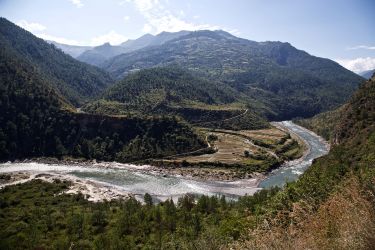
Is Bhutan's earthquake hiatus over?
Banner image: A view of the devastation of February 6, 2016 earthquake in city of Tainan, Taiwan, which killed 114 people. Picture: Reuters
Subscribe to Up Close through iTunes, SoundCloud or RSS.